The Hunt for Hydrilla Continues
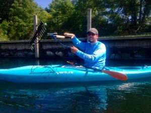 Our survey efforts in 2019 are focused on the boat movement pathway of invasion. Specifically, we are surveying areas around boat launches and marinas. We started out collecting macrophyte data every 100 meters anywhere the water depth was 25 feet or shallower, within 1 mile of a launch/marina. Once Hydrilla was detected in late August, we started collecting data every 25 meters within 0.3 miles of the launch/marina (still wherever water depth was 25 feet or shallower).
We chose our sites from waterbodies with known infestations (Cayuga Lake), waterbodies nearby known infestations (Owasco, Seneca, and Skaneateles Lake), waterbodies with high-use launches (Canandaigua, Keuka, Conesus Lake), and Lake Ontario embayment (Sodus Bay).
Use the map controls to zoom into an area and read the related information below. Or scroll through the article and the corresponding map point will be highlighted/
Subscribe
If you enjoyed this article, subscribe to receive more just like it.